
A weather report comprises of just a few dozen characters. But rendering it in a meaningful way so that a pilot understands it at a glance turns out to a challenge. And drawing clouds isn't easy! It's bugged me that some sky conditions looked really strange and especially difficult were situations with low cloud and multiple overlapping conditions.
Problems with low level cloud
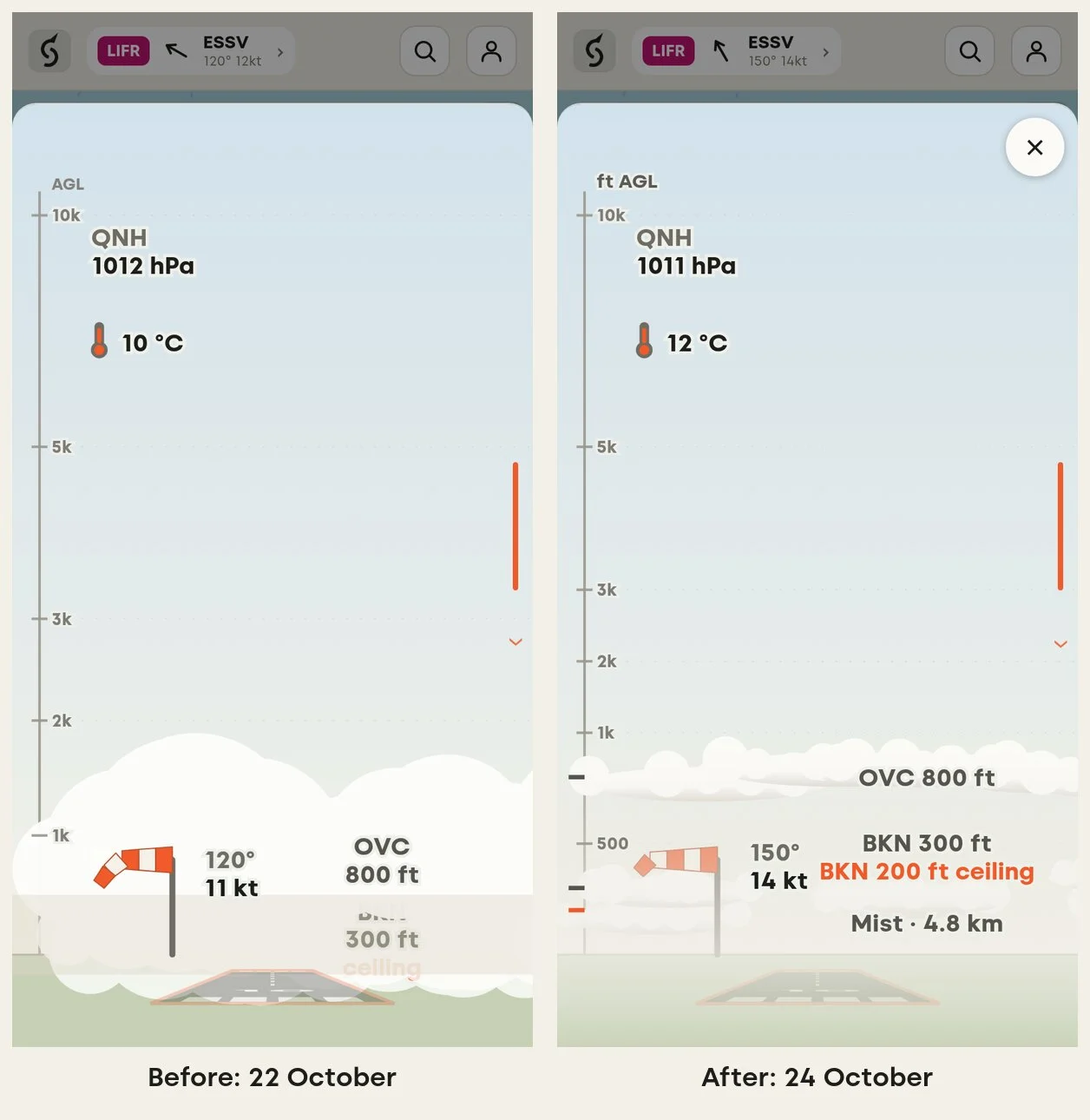
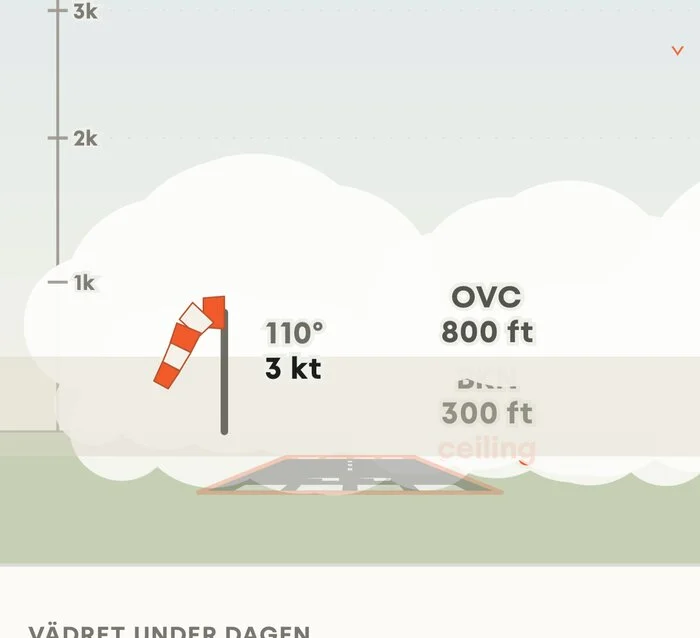
I saw an example from Norrköping (ESSP): broken cloud at 200 and 300 ft, overcast at 800 ft, mist. Squawkr interpreted the information correctly but had printed the three cloud condition labels on top of each other, painted the mist band over the text and drawn the overcast cloud below ground level.
There are clouds and there are clouds
With a bit of test and error, I managed to refactor the visualisation to make different conditions much clearer to understand:
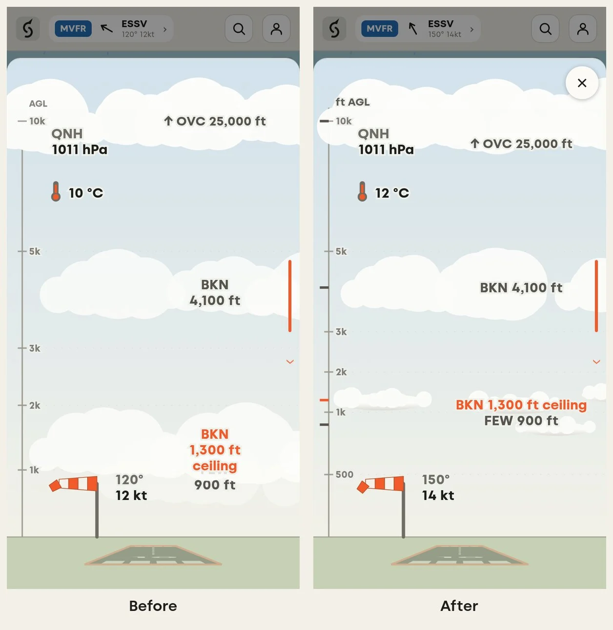
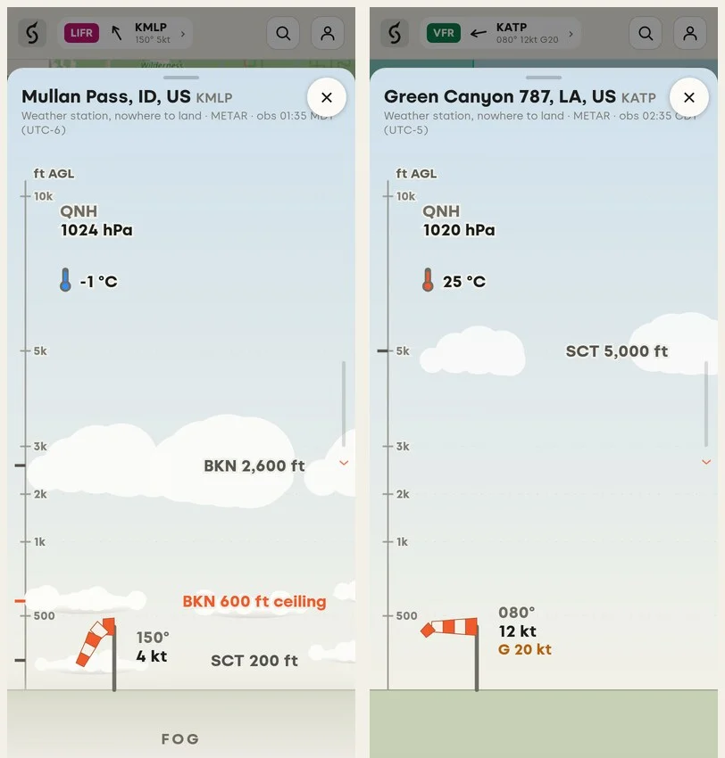
- Low cloud is a flat deck. Below about 1,500 ft cloud is stratus, not heaped cumulus, so it is now drawn wide and shallow, with a flat base and an uneven top.
- One text line per layer. For example, "BKN 200 ft ceiling" is now one line of text. This means a three-layer fog went from nine lines of text to three.
- More room for low altitudes. If all altitudes were equal, the lowest 1,000 ft, where most VFR decisions are made would only get a sliver of the screen. It now gets 30 % of the sky, with a 500 ft tick. This gives more screen real estate to see different conditions at low altitudes.
- Cover in eighths. Cloud cover is reported in oktas, eighths of the sky: FEW is 1–2, SCT 3–4, BKN 5–7 and OVC 8. The old drawing showed scattered cloud as almost solid. This is now improved to more accurately show the real conditions.
Fog and mist start at the ground
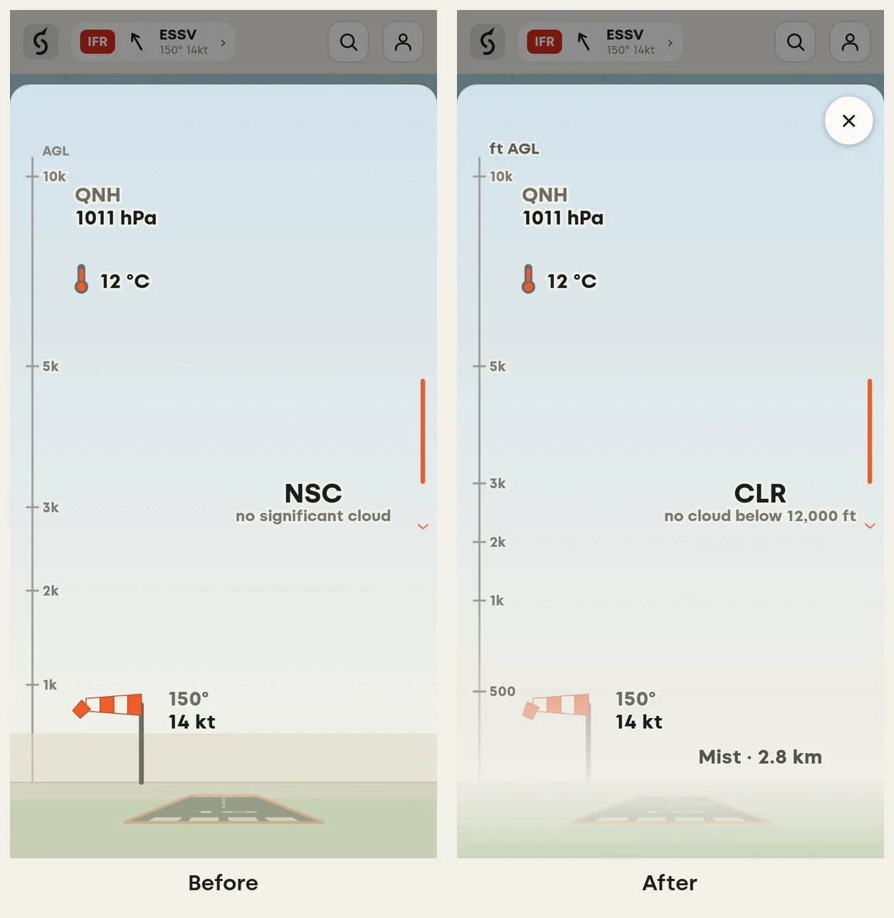
On Saturday at Lake Charles (KLCH) the report was for mist under a clear sky. The app drew a hard beige strip with "2.8 km visibility" written under the ground. This also needed to be reworked. We fixed labelling and ensured the visibility labels better positioned. Fog and mist now make a simpler and more authentic effect by occluding the wind sock and runway whilst still keeping labels clear and understandable.
Not every METAR is an airfield
Some METARs come from a mountain pass, an oil platform or a lake. These now show as diamonds on the map and open a sky-only panel marked "Weather station, nowhere to land".
Feedback appreciated
I hope these improvements make a difference for you - as always, feedback and suggestions are appreciated. And if you have any good tips on illustrating authentic cloud shapes I am happy for the help!!
Squawkr is not an official flight briefing source. Always check the official weather and NOTAMs for your flight in LFV AROWeb (aro.lfv.se) before you fly.