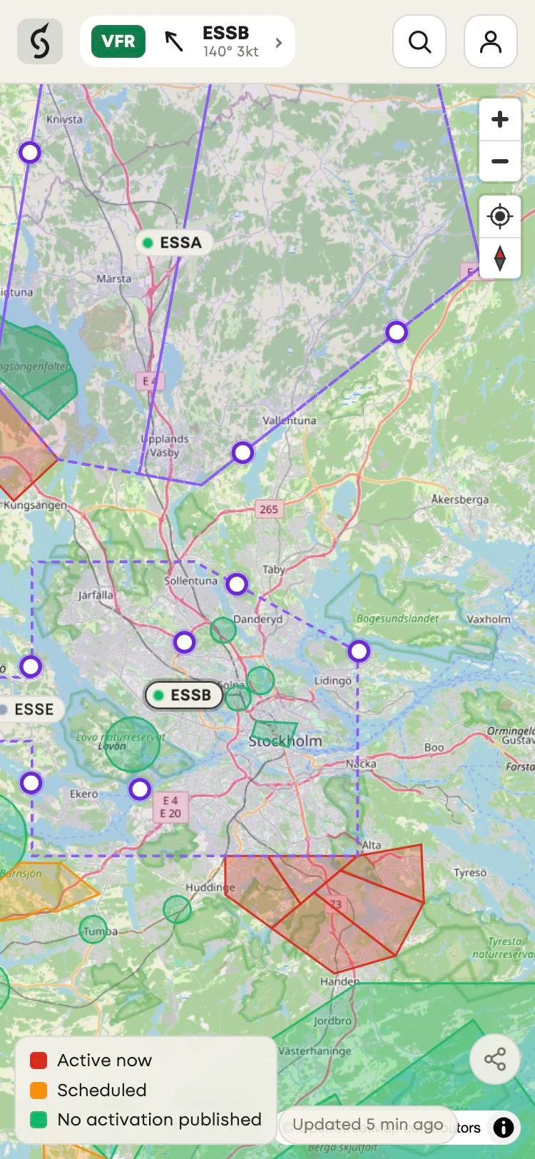
This release makes the entry and exit points of Swedish control zones easy to find on the map. It also adds a restriction area map filter for signed-in users and fixes the navigation bar of the installed Android app in dark mode.
At a glance
| Released | 23 October 2026 |
| Open it | Open the app in Safari on iPhone, Chrome on Android or any desktop browser |
| Price | Free |
| Coverage | Entry and exit points: Sweden. Map filter: everywhere Squawkr shows restriction areas. |
What's new
Larger entry and exit points
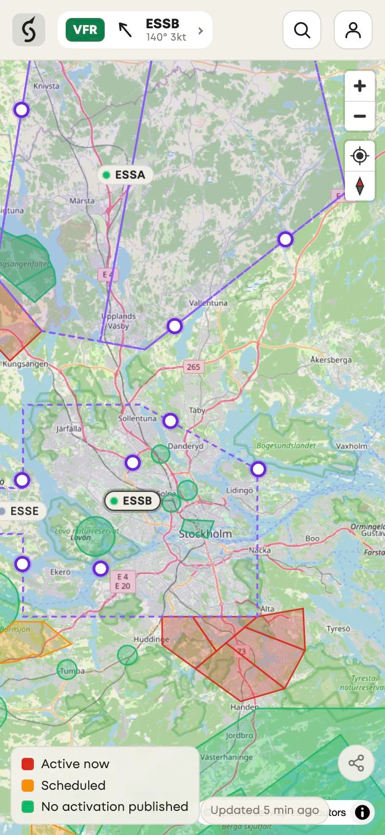
Control zones have published entry and exit points. Until now Squawkr drew them as small dots that were easy to miss on a busy map. They are now larger violet rings, shown from about zoom 8 and drawn above the dashed zone border.
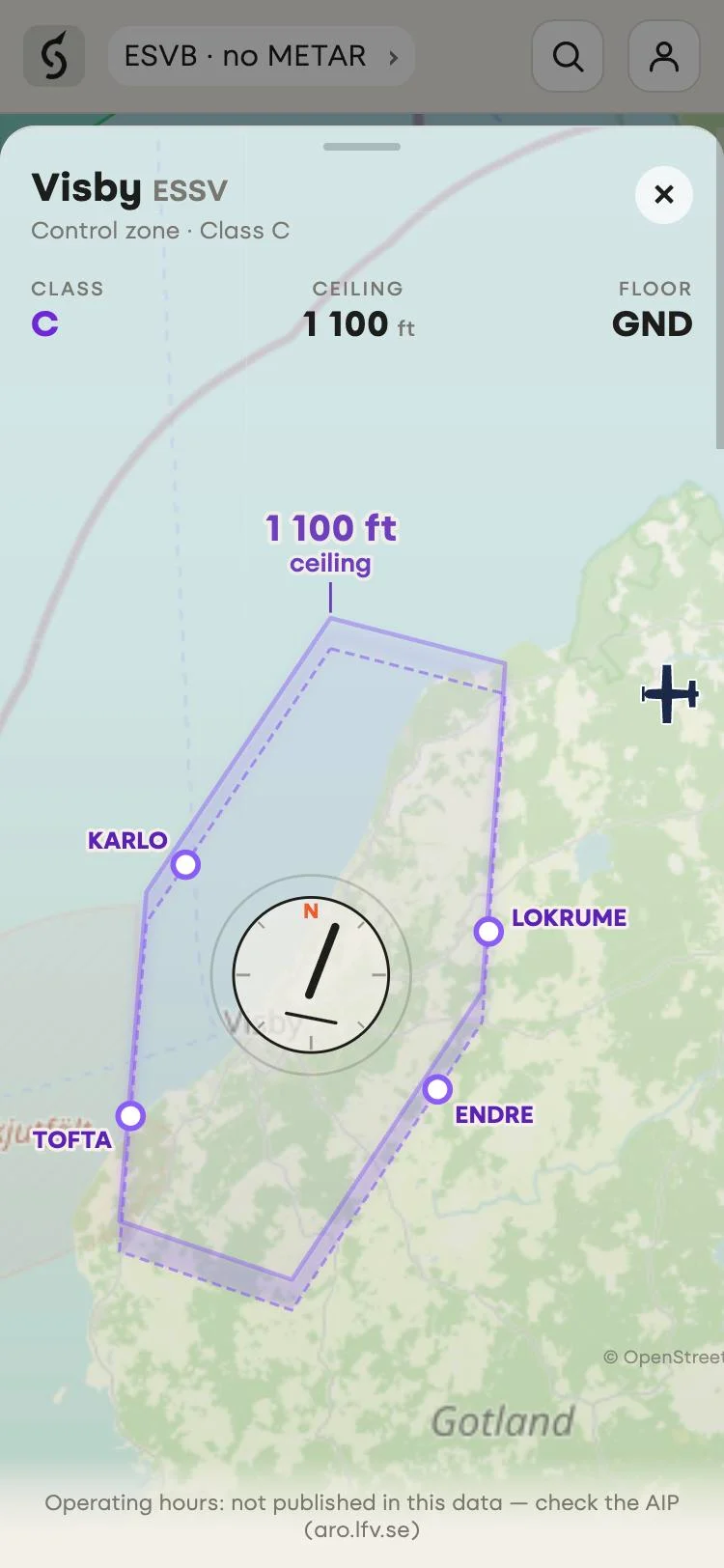
The points come from Swedish national aeronautical data, so they are shown in Sweden only for now. The map does not show their names yet. Open a control zone to see them named on the zone diagram, together with your position when you are nearby.
A map filter with a default height limit
Two high-level danger areas, ES D309 and D311, go from FL520 to FL660. When they were active, the map showed them in red, which suggested something near you was active. Light aircraft and drones do not fly at those levels.
The map now hides every area whose floor is FL150 or higher by default. A hidden area is not on the map, not in the "active now" count and not in search results.
With a free account you can change this. Open the account menu and choose Map filter, under Profile. You can set:
- the floor height above which areas are hidden: FL95, FL150, FL195 or no limit
- which area types you see, such as Restricted (R), Danger (D) and Prohibited (P), plus the US types
- whether temporary areas from AIP SUP and NOTAM are shown
- which statuses you see: active, scheduled, no published activation or no data
Squawkr saves the filter on your account, so your phone and your laptop use the same settings. Without an account you get the default filter. The account is free, and so is everything in the app.
A dark navigation bar on Android
In the installed Android app in dark mode, the bar at the bottom of the screen was cream, and Android drew the back and home keys on it in pale grey. The keys were hard to see. In dark mode the bar is now dark.
This changes the installed app only. Squawkr in a browser tab, in light mode or on iPhone looks the same as before.
Improvements
- A small plane marks your position on the map. The map follows it until you drag the map away. The compass button switches between north up and heading up.
- When you open a control zone and you are within 40 km of its edge, a "Your position" card shows the distance and bearing to each entry and exit point. Your position stays on your device.
- The plane icon is now a light single-engine aircraft instead of an airliner.
- The zone diagram also shows the plane when you are inside the zone or within 40 km of it.
Fixes
- Times for places at UTC+0, such as London in winter, now show "UTC+0" instead of only "GMT".
Known limitations
- Entry and exit points are shown in Sweden only. Their names appear on the zone diagram, not on the map.
- Without an account, the map hides areas with a floor at FL150 or higher. If you fly that high, sign in and change the filter, or check the official source.
- The Android fix applies to the installed app only. A browser tab uses the browser's own bar.
Before you fly
Squawkr is not an official flight briefing. Always verify activations and NOTAMs with the official source for the territory you fly in, such as LFV AROWeb in Sweden, and check signs on site for ground access.