
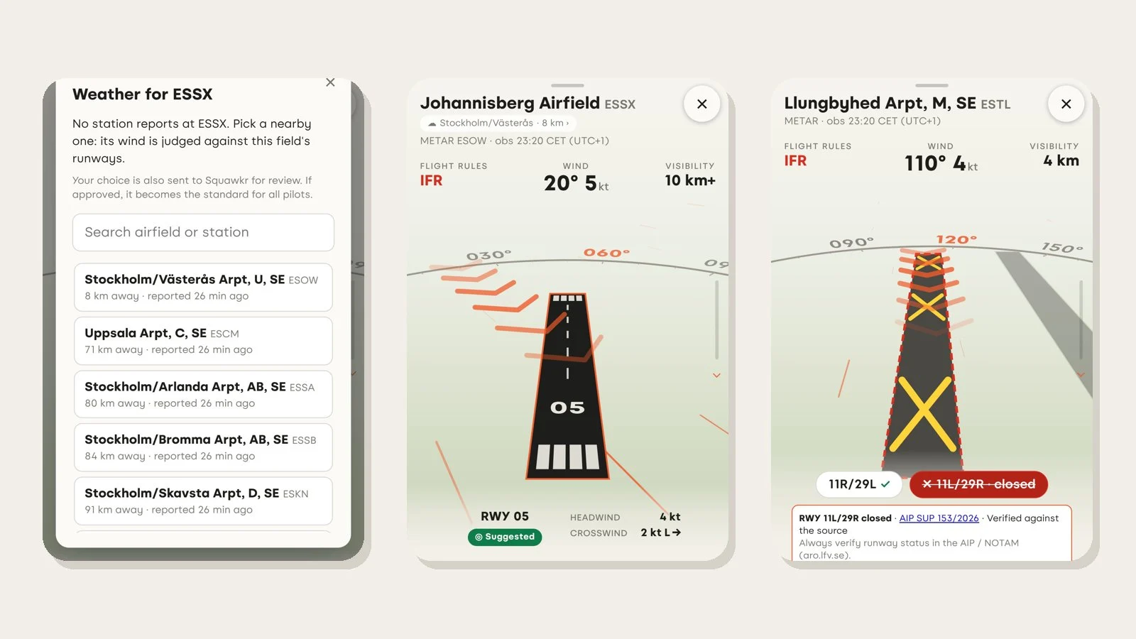
Many of the fields pilots actually fly from — club fields, grass strips, private strips — publish no METAR. Until now, Squawkr showed those fields with a runway and nothing else: no wind, no cloud, no visibility. This update lets you fill that gap yourself, and we also make it much easier to tell us when something about a field or a restriction area is wrong.
Borrow a nearby station's weather
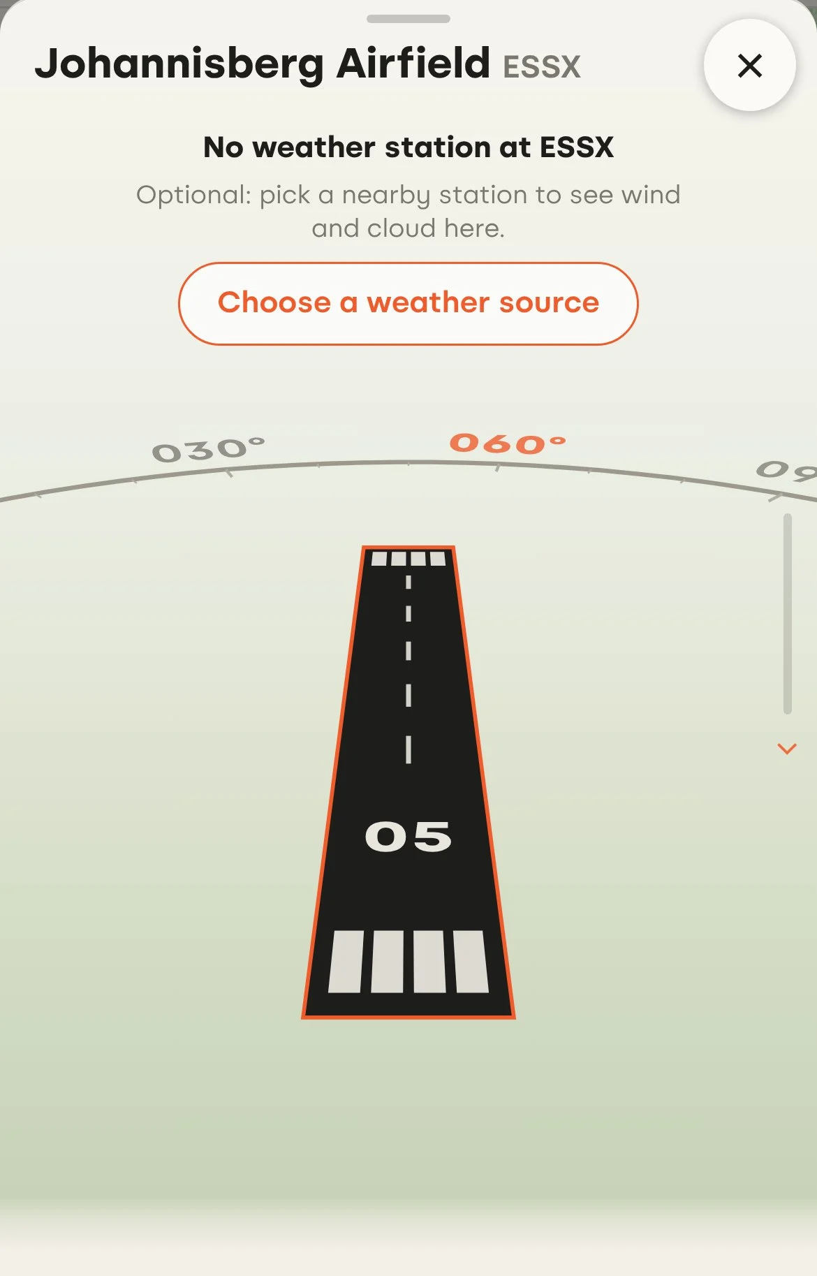
Open a field without its own weather report and you'll see a short note under its name: No weather station at ESSX, with one button, Choose a weather source. It is optional — if you only want the field itself, ignore it.
The picker lists the reporting stations nearest the field, with the distance and how long ago each one reported. The search box narrows the list and reaches any airport by name or code.
Pick a station and the field fills in. The wind is judged against this field's runways, so you get a suggested runway, headwind and crosswind for the strip you are actually flying from. Cloud, visibility and the sky view come from the station you chose.
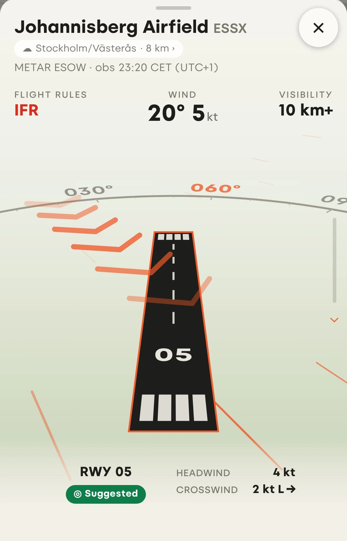
Squawkr never pretends the weather is from the field. A small pill beside the name says whose weather it is and how far away ("☁ Stockholm/Västerås · 8 km"), and the details say it plainly: observed there, not at this field. Tap the pill to change station or stop using it.
A few things worth knowing:
- This feature needs a free account. Your choice is saved to your account, so it is there on your phone, tablet and computer.
- Your choice is also a suggestion. When you pick a station, it is sent to us for review. If it's approved, it becomes the standard for that field for every pilot, marked "set by local pilots".
- Distance matters, and you judge it. A station 8 km away tells you a lot; one 70 km away much less. The distance is always shown so you can decide.
Closed runways stay on the map, clearly marked
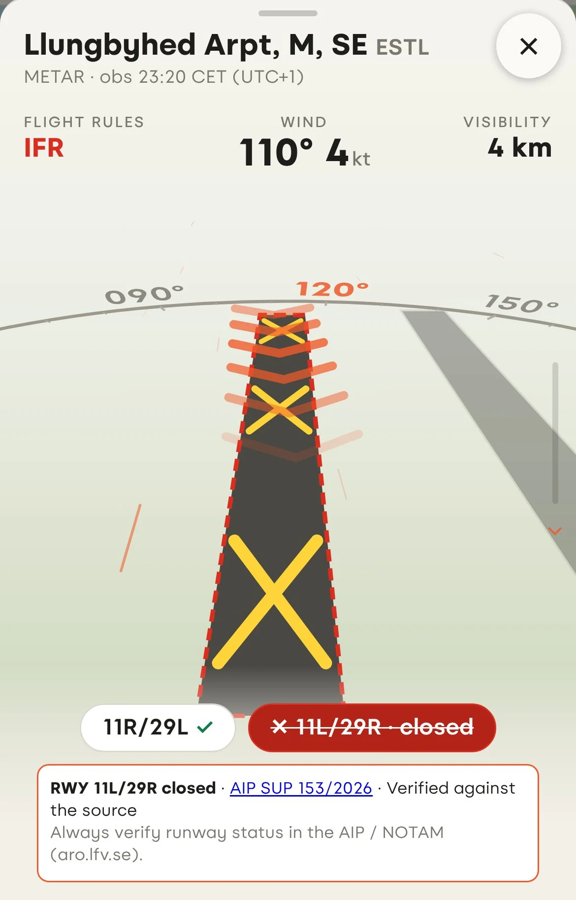
A closed runway used to simply disappear. Now it stays visible, so the field looks like the field you'll see from the air: drawn muted with a red dashed outline and the yellow X at each end, a red dashed line on the satellite view, and a struck-through closed chip beside the open runways.
It is never suggested and never counted in crosswind. Tap it and you'll see why it's closed and where that comes from — at Ljungbyhed, runway 11L/29R is closed by AIP SUP 153/2026, verified against the source.
Spot something wrong? Tell us in a few taps
Our data comes from official sources, but those change and we don't always catch it in time. You are often the first to know: you saw the sign, heard it on the radio, or read the NOTAM.
Every airfield now has a Spot something wrong? card right by the airfield view, and every restriction area has one just under its schedule. It replaces the small link that used to hide at the bottom of the page.
The form asks what is wrong with one-tap choices that fit the place — a runway closed or open again and the operating hours on an airfield; the status, height limits or boundary on a restriction area — and how you know: on-site signage, radio, AROWeb, a NOTAM, or seeing the activity yourself. Add a sentence if you like, and send.
Every report is checked against official sources before it changes what other pilots see.
Before you fly
Squawkr is not an official flight briefing. Weather borrowed from another station was observed there, not at your field. Always check runway status, NOTAMs and restriction areas on LFV AROWeb (aro.lfv.se) and on the signs on site.